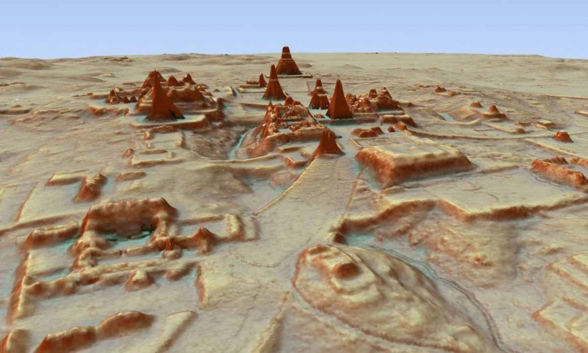
Scientists using airplane-based lidar mapping tools have discovered tens of thousands of structures constructed by the Maya. The structures include defense works, houses, buildings, industrial-size agricultural fields and even new pyramids.
The lidar system fires rapid laser pulses at surfaces and measures how long it takes that light to return to sophisticated measuring equipment. Thomas Garrison, an archaeologist at Ithaca College who led the project, called the discovery monumental.
“We don’t use about 92 percent of the lidar data. We just throw it out to make our maps,” Garrison told the Washington Post. “But there is incredibly valuable information in that forestry data. You’re just seeing the archaeology part because that’s what we focused on, but that data can be used to determine how jungles recover from forest fires, what’s the carbon footprint.”
Thanks for reading InsideHook. Sign up for our daily newsletter and be in the know.


