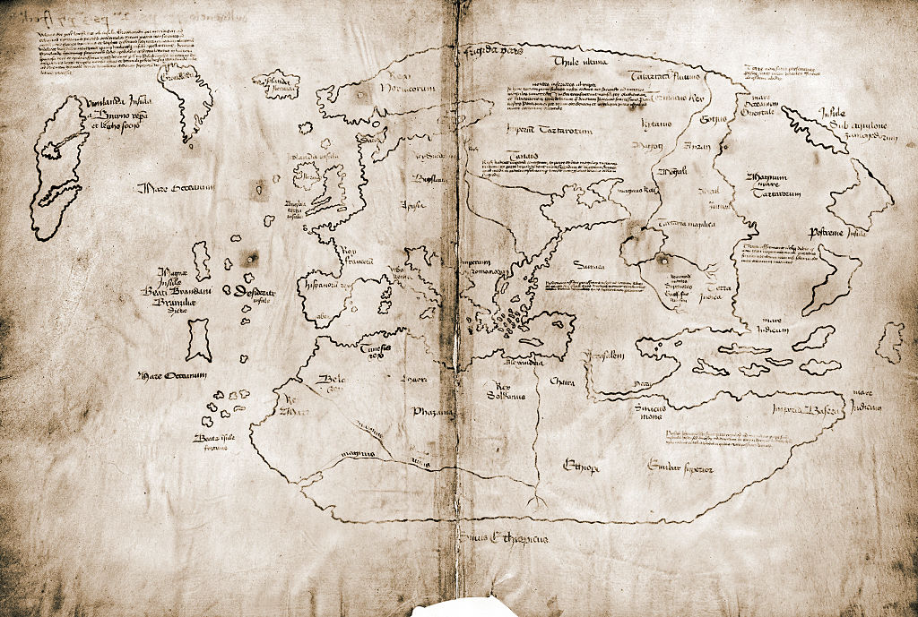
Though not without controversy at the time, when a document purporting to be a mid-15th-century European map of North America came into the possession of Yale University in 1965, it was a major event. The Vinland Map, as it is known, offered a very different take on European exploration of the Americas than the conventional wisdom at the time. And while some of the Vinland Map’s conclusions ended up being proven correct, it turns out the Vinland Map itself is a hoax — one with a history measured in decades, not centuries.
While the map’s authenticity has been called into question before, these new findings offer the most comprehensive debunking to date. Writing at Smithsonian Magazine, David M. Perry and Matthew Gabriele have details on the cross-disciplinary effort to explore the map’s origins.
At the heart of those efforts was X-ray fluorescence spectroscopy, which determined that the ink used for the map contained titanium — something that wasn’t really done until the 1920s. This was, perhaps, the largest indicator that the Vinland Map was not what it purported to be, but it wasn’t the only one.
Intriguingly, some were skeptical about the map from the beginning. In 1957, Smithsonian reports, the map was offered to the British Museum, who passed on it owing to questions over its authenticity. All of which suggests that the story of how this hoax came about might be a fascinating story all its own — and a true one to boot.
Thanks for reading InsideHook. Sign up for our daily newsletter and be in the know.
